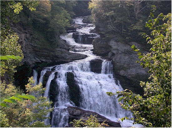
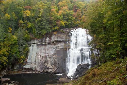
1. Cullasaja Falls
Visible from U.S. 64, in Cullasaja Gorge, 11 mi. east from Franklin, 9 mi. west from Highlands. Height 250 ft. Accessible by foot trail, a half-mile through steep, rough terrain.
Latitude
35.117609°
Longitude
-83.270246°
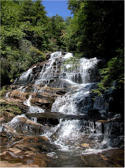
1A. Bust your Butt Falls
Approx. 7 miles west of Highlands. After passing Cullasaja Falls, go 2 miles toward the Highlands, NC on U.S. 64. Visible from U.S. 64,
Latitude
35.092577°
Longitude
-83.265916°
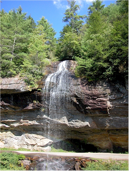
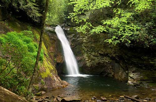
2. Dry Falls
Located near U.S. 64, 3.5 mi. west from Highlands, 16.5 mi. east from Franklin. Paved walkway leads to falls from parking area. Walk underneath the 75 ft. falls.
Latitude
35.068467°
Longitude
-83.238569°
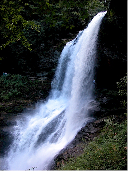
3. Bridal Veil Falls
2.5 mi. west of Highlands on U.S. 64. Visible from the highway, which at one time routed traffic under the falls. Height 120 ft.
Latitude
35.072357°
Longitude
-83.229289°
4. Glen Falls
From Highlands, travel 3 mi. south on NC 106. Turn left on U.S. Forest Service Rd. with "Glen Falls" marker. One-mile trail to falls is steep and rough. Consists of three large falls, each dropping approx. 60 feet
Latitude
35.031494°
Longitude
-83.238430°
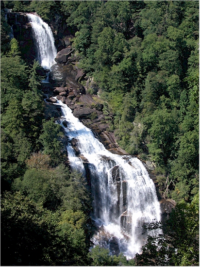
5. Whitewater Falls
At 411 ft., the highest falls in Eastern America.
From Cashiers, take U.S. 64 east, 10 mi. to
"Whitewater Road." Falls are located
10 mi. south on Whitewater Rd., near the NC-SC
state line. Drift, Horsepasture and Rainbow
Falls are also accessible from Whitewater Rd.
Whitewater Falls can also be reached from N.C.
107, south of
Cashiers.
Latitude
35.035820°
Longitude
-83.017544°
6. Rainbow Falls
From Cashiers, take U.S. 64 to N.C. 281 South. The trail to the falls is two miles from this intersection.
7. Toxaway Falls
This falls can be seen from your car as you cross the Toxaway River on U.S. 64 East near Rosman.
8. Courthouse Falls
Take US 64 East to N.C. 215 North. Travel 10 miles and take right on Courthouse Creek Road. Trailhead well marked.
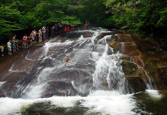
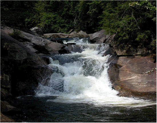
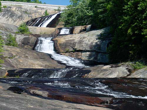
9. Sliding Rock
This natural waterslide is a favorite of many people. Just jump in the water at the top of the falls and slide down the rock face to the bottom. 11,000 gallons of 50 to 60 degree water rushes down the rock every minute. Take 276 North from Brevard. 7 Miles north of the Ranger Station.
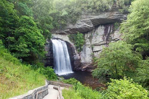
10. Looking Glass Falls
Take 276 North from Brevard. Falls is approximately 4 miles north of Ranger Station. Parking area is well marked. Short walk to falls.
11. Indian Creek Falls
From Bryson City, take "Deep Creek Rd." north 3 mi. to Deep Creek Campground in the Great Smoky Mountains National Park. One-mile hike to falls is classified as "easy". Height 60 ft.
12. Juneywhank Falls
From Bryson City, follow directions to Indian Creek Falls. Juneywhank Falls are one-quarter mile downstream from Indian Creek.

13. Tom's Branch Falls
From Bryson City, see directions to Indian Creek Falls. A quarter-mile walk from Deep Creek Campground.
14. Rufus Morgan Falls
This easy one mile loop trail is named after Rufus Morgan, a naturalist who was instrumental in developing the Appalachian Trail. Take U.S. 64 for 3 miles west of Franklin. Turn right at Wayah Bald directional sign. Take first left onto Wayah Road (S.R. 1310). 6.6 Miles and then left of F.S. Road 388. Trail 2.2 miles on right
Latitude
35.162601°
Longitude
-83.540092°
15. Laurel Falls
From Franklin, Go 9 miles west on U.S. 64. Turn left on Wallace Gap Road (Old U.S. 64) and go 1.5 miles. Turn right on F.S. Road 67 (toward Standing Indian Campground) and go 7 miles (5 miles past Back Country Information Center). Trail runs along an old railroad grade. After passing over bridge, it splits; right ends at Big Laurel Falls.
Latitude
35.113376°
Longitude
-83.523804°
16. Mooney Falls
From Franklin, See directions to Big Laurel Falls, continuing for .7 mile past Big Laurel Falls trailhead. A very short trail descends to Mooney Falls. Roadside parking available.
Latitude
35.113900°
Longitude
-83.523833°
Silver Run Falls
4.1 Miles South of Hwy 64
& Hwy. 107 Intersection In Cashiers
Latitude
35.067163°
Longitude
-83.064231°
Holcomb Creek Falls
Accessed From The Holcomb Creek Trail

